About Race Hawks
The map I wish I’d had.
Hi, I’m Asher Zaczepinski, a junior cross country runner at Santa Monica High School. I came up with the idea for Race Hawks at the end of my freshman season and have been building it ever since.
It started as a way to prep for my next race. Over time it grew into full flyovers, elevation data, and race-strategy tools. These days it takes up most of my free time after practice. I hope it helps you and your team prep for courses and chase PRs.

Santa Monica High School XC
Where it started
My first XC meet, and one nasty hill.
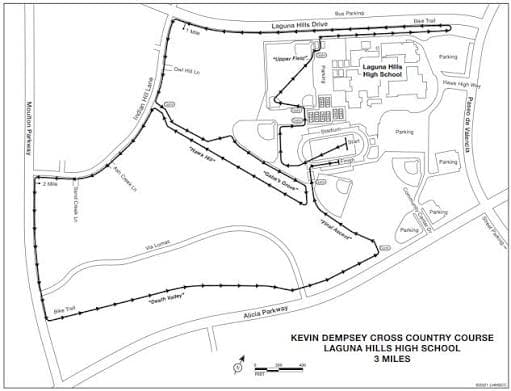
Laguna Hills was my very first XC meet, and the paper map below was about all I had going in. I knew there was a “Hawk Hill” (not related in any way to Race Hawks), but I had no idea how brutal it actually was.
I went out at a pace I couldn’t hold, and the hill wrecked me. By the final stretch my legs were gone.


The fix
What Race Hawks does.
Every course gets a full flyover video, so you can watch the whole route from above before you ever step on it. Elevation and grade are laid out along the way, so you know exactly where the hills are and how steep they get. No more finding out about a Hawk Hill the hard way.
Then there’s the strategy side: pick a goal time and build your race plan split by split, adjusted for the terrain. You’ll know where to hold back and where to push. By race day the course already feels like a home course, and you can hawk down your competitors : )
Climbing Hawk Hill on Laguna Hills, miles 1.63–1.72 (red = steep).
A real 18:40 plan for Laguna Hills, live, split by split.